Geolocate

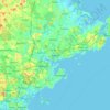
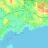
Beverly topographic maps

Click on a map to view its topography, its elevation and its terrain.

Beverly

United States > Massachusetts > Essex County > Beverly

Average elevation: 56 ft

Gear up for your next adventure:

🧥Waterproof Jacket for Hiking - Breathable and rugged rain jacket for outdoor excursions
🧯Portable Fire Pit - Compact fire pit for camping spots
🗺️NatGeo Topo Maps - High-quality waterproof printed topographic maps of US Parks
🧭Orienteering Set - Complete compass and map reading kit
🌎3D Topographic Globes - Raised relief globes for a tactile understanding of geography

As an Amazon Associate, this site earns from qualifying purchases at no extra cost to you.