Geolocate

Suez topographic maps

Click on a map to view its topography, its elevation and its terrain.
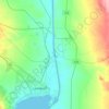
Suez Canal

Egypt > Suez > Suez

Despite the construction challenges that could have been the result of the alleged difference in sea levels, the idea of finding a shorter route to the east remained alive. In 1830, General Francis Chesney submitted a report to the British government that stated that there was no difference in elevation and…

Average elevation: 128 ft

Gear up for your next adventure:

🗺️NatGeo Topo Maps - High-quality waterproof printed topographic maps of US Parks
🪶Paracord Bracelet - Survival bracelet with built‑in tools
⌚GPS Sports Watch - GPS watch for running, hiking and training
🔭Telescopic Hiking Pole - Adjustable pole for hiking stability
🌧️Backpack Rain Cover - Keep gear dry in wet weather

As an Amazon Associate, this site earns from qualifying purchases at no extra cost to you.