Geolocate

Matadepera topographic maps

Click on a map to view its topography, its elevation and its terrain.
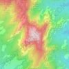
la Mola

España > Cataluña > Vallés Occidental > Matadepera

La Mola (cuyo nombre significa, literalmente, «la mesa») es la montaña más alta del parque natural de San Lorenzo del Munt y del Obac con 1104 metros de altitud (partiendo del nivel del mar)​ y es uno de los elementos característicos del paisaje en toda la comarca.

Average elevation: 2,457 ft
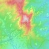
Can Pobla

España > Cataluña > Vallés Occidental > Matadepera

Average elevation: 2,234 ft

Gear up for your next adventure:

📚Navigation Handbooks - Master the art of reading topographic maps and using a compass
Backpacking Tent - Lightweight and durable tent for multi‑day hikes
🦟Ultrasonic Repellers - Create a bug-free zone at your camp or rest stop
🔥Camping Stove - Portable stove for camping and backcountry cooking
🥘Titanium Cookware - Durable, featherlight pots and pans for backpacking

As an Amazon Associate, this site earns from qualifying purchases at no extra cost to you.