Geolocate

Alcorcón topographic maps

Click on a map to view its topography, its elevation and its terrain.

Alcorcón

España > Comunidad de Madrid > Alcorcón

Durante el reinado de Felipe II (1556-1598) se publicaron las Relaciones Topográficas de Felipe II, una enciclopedia en la que se recogieron los datos topográficos e históricos de los pueblos de Castilla. En el capítulo II figura.

Average elevation: 2,119 ft
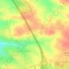
Casco Antiguo

España > Comunidad de Madrid > Alcorcón

Average elevation: 2,287 ft

Norte

España > Comunidad de Madrid > Alcorcón

Average elevation: 2,283 ft

Suroeste

España > Comunidad de Madrid > Alcorcón

Average elevation: 2,257 ft

Gear up for your next adventure:

🦟Ultrasonic Repellers - Create a bug-free zone at your camp or rest stop
😴Insulated Sleeping Pads - Compact and warm pads for high-elevation camping
🔋Solar Power Banks - Keep your GPS and phone charged in remote wilderness areas
🥩Freeze-Dried Meals - Nutritious and lightweight food for remote expeditions
💧Water Filtration Bottles - Safely drink from streams and lakes while exploring

As an Amazon Associate, this site earns from qualifying purchases at no extra cost to you.