

Simmerath topographic maps
Click on a map to view its topography, its elevation and its terrain.

Hammer
Duitsland > Noordrijn-Westfalen > Städteregion Aachen > Simmerath
Hammer ligt in de Eifel, in het dal van de Roer op een hoogte van 330 meter. De Belgenbach, Brommersbach en Riffenbach monden uit in de Roer.
Average elevation: 1,519 ft
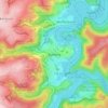

Rursee
Duitsland > Noordrijn-Westfalen > Städteregion Aachen > Simmerath > Woffelsbach
Average elevation: 1,188 ft