Geolocate

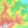
Phulara topographic maps

Click on a map to view its topography, its elevation and its terrain.

Phulara

India > Himachal Pradesh > Chamba > Khajjiar > Phulara

Average elevation: 5,781 ft

Gear up for your next adventure:

🪶Multi‑Purpose Knife - Useful blade for camp and trail
🧭Map Reading Tools - Tools and kits for map navigation
🧣Merino Neck Gaiters - Multi-functional headwear for wind and sun protection
🔥Camping Stove - Portable stove for camping and backcountry cooking
🎒Outdoor Daypacks - Lightweight backpacks designed for carrying maps and essential gear

As an Amazon Associate, this site earns from qualifying purchases at no extra cost to you.