
Venice topographic map
Interactive map
Click on the map to display elevation.
Venice
Venice is characterized by its predominantly flat terrain, situated at an elevation of approximately 15 feet above sea level. This coastal city features sandy beaches along the Gulf of Mexico and is interspersed with various waterways, including canals and lakes that contribute to its scenic environment. The area is mostly composed of low-lying land, with gentle slopes that lead towards the waterfront, enhancing its accessibility to the beach and recreational water activities. Surrounding wetlands and natural preserves further enrich the topography, supporting diverse ecosystems while providing natural buffers against coastal erosion.
About this map
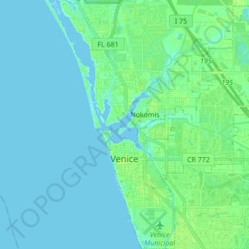
Name: Venice topographic map, elevation, terrain.
Location: Venice, Sarasota County, Florida, 34285, United States (27.06068 -82.46783 27.16894 -82.35958)
Average elevation: 10 ft
Minimum elevation: -7 ft
Maximum elevation: 39 ft
Sarasota County trails, hiking, mountain biking, running and outdoor activities
Other topographic maps
Click on a map to view its topography, its elevation and its terrain.
Nokomis
United States > Florida > Sarasota County
Nokomis features a predominantly flat and low-lying terrain characteristic of the coastal region. The elevation in Nokomis rarely exceeds 15 feet above sea level, contributing to its vulnerability to tidal influences and storm surges. The area is interspersed with wetlands and mangroves, particularly near the…
Average elevation: 16 ft
Englewood
United States > Florida > Sarasota County
Englewood features predominantly flat and low-lying terrain typical of the region's coastal landscape. The average elevation here is approximately 15 feet above sea level, which makes the area particularly susceptible to tidal influences and storm surges. The terrain is interspersed with wetlands and…
Average elevation: 10 ft
South Gate Ridge
United States > Florida > Sarasota County > South Gate Ridge
Average elevation: 39 ft
Venice Area Audubon Rookery
United States > Florida > Sarasota County > South Venice > Venice Groves
Average elevation: 20 ft
Ridge Wood Heights
United States > Florida > Sarasota County > Ridge Wood Heights
Average elevation: 33 ft
Gulf Gate Estates
United States > Florida > Sarasota County > Gulf Gate Estates
Average elevation: 23 ft