
Ogooué-Ivindo topographic map
Interactive map
Click on the map to display elevation.
About this map
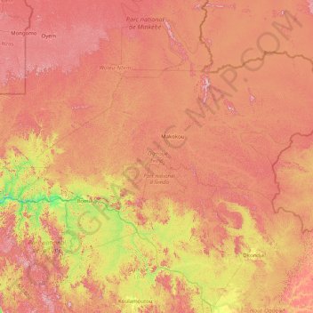
Name: Ogooué-Ivindo topographic map, elevation, terrain.
Location: Ogooué-Ivindo, Gabon (-0.73169 11.27167 1.43775 14.49611)
Average elevation: 1,565 ft
Minimum elevation: 279 ft
Maximum elevation: 3,248 ft
Other topographic maps
Click on a map to view its topography, its elevation and its terrain.
Cap Lopez
Gabon > Ogooué-Maritime Province > Port-Gentil
Cap Lopez, Port-Gentil, Ogooué-Maritime Province, Gabon
Average elevation: 3 ft
Port-Gentil
Gabon > Ogooué-Maritime Province
Port-Gentil, Ogooué-Maritime Province, Gabon
Average elevation: 3 ft
Romboe
Gabon > Estuaire > Komo Department
Romboe, Komo Department, Estuaire, Gabon
Average elevation: 135 ft