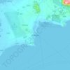
Linesøya topographic map
Click on the map to display elevation.
About this map

Name: Linesøya topographic map, elevation, terrain.
Location: Linesøya, Åfjord, Trøndelag, 7176, Norge (63.99519 9.84048 64.05126 9.95592)
Average elevation: 72 ft
Minimum elevation: 0 ft
Maximum elevation: 738 ft
Other topographic maps
Click on a map to view its topography, its elevation and its terrain.