
咸安区 topographic map
Interactive map
Click on the map to display elevation.
About this map
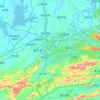
Name: 咸安区 topographic map, elevation, terrain.
Location: 咸安区, 咸宁市, 湖北省, 中国 (29.65502 114.11612 30.03545 114.72218)
Average elevation: 417 ft
Minimum elevation: 49 ft
Maximum elevation: 3,051 ft
Other topographic maps
Click on a map to view its topography, its elevation and its terrain.