
桂花镇 topographic map
Interactive map
Click on the map to display elevation.
About this map
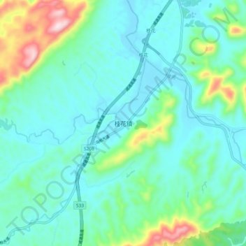
Name: 桂花镇 topographic map, elevation, terrain.
Location: 桂花镇, 咸宁市, 湖北省, 中国 (29.68135 114.30521 29.76135 114.38521)
Average elevation: 443 ft
Minimum elevation: 135 ft
Maximum elevation: 1,647 ft
Other topographic maps
Click on a map to view its topography, its elevation and its terrain.