Geolocate

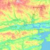
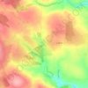
Rossmore topographic map

Click on the map to display elevation.

About this map

Name: Rossmore topographic map, elevation, terrain.

Location: Rossmore, West Cork, County Cork, Munster, P85 TA48, Ireland (51.64656 -9.01137 51.69180 -8.92201)

Average elevation: 305 ft

Minimum elevation: 125 ft

Maximum elevation: 617 ft

Other topographic maps

Click on a map to view its topography, its elevation and its terrain.

Skibbereen

Ireland > County Cork > Skibbereen

Average elevation: 157 ft

Cork

Ireland > County Cork > Cork

Average elevation: 308 ft

Mallow

Ireland > County Cork > Mallow

Average elevation: 348 ft

Ringaskiddy

Ireland > County Cork

Average elevation: 43 ft

Youghal

Ireland > County Cork > Youghal

Average elevation: 75 ft

Garnish Island

Ireland > County Cork

Average elevation: 433 ft

Glounthaune

Ireland > County Cork

Average elevation: 171 ft

Glanmire

Ireland > County Cork

Average elevation: 190 ft

Ballincollig

Ireland > County Cork > Cork

Average elevation: 203 ft

Waterfall

Ireland > County Cork

Average elevation: 315 ft

Mizen Head

Ireland > County Cork

Average elevation: 82 ft

Innishannon

Ireland > County Cork > Innishannon

Average elevation: 184 ft

Dripsey

Ireland > County Cork

Average elevation: 279 ft

Butter Bridge

Ireland > County Cork

Average elevation: 230 ft

Lombardstown

Ireland > County Cork

Average elevation: 295 ft

Allihies

Ireland > County Cork

Average elevation: 302 ft

Little Island

Ireland > County Cork

Average elevation: 112 ft

Ballydesmond

Ireland > County Cork > Ballydesmond

Average elevation: 807 ft

Myrtleville Beach

Ireland > County Cork

Average elevation: 105 ft

Passage West

Ireland > County Cork > Passage West

Average elevation: 108 ft

Milford

Ireland > County Cork

Average elevation: 390 ft

Elizabeth Fort

Ireland > County Cork > Cork

Average elevation: 92 ft

Leamlara

Ireland > County Cork

Average elevation: 476 ft

Abbey Mount

Ireland > County Cork

Average elevation: 302 ft

Castletownbere

Ireland > County Cork > Castletownbere

Average elevation: 289 ft

Gear up for your next adventure:

🧭Compass with Lanyard - Easy‑carry compass for navigation
📌Outdoor GPS Map App - Apps and devices for digital topographic navigation
🦶Carbon Trekking Poles - Reduce knee impact on steep descents with ultra-light poles
☀️Outdoor Sunscreen - High protection sunscreen for outdoor activities
🧥Men's Rain Shells - Premium waterproof and breathable jackets for mountain weather

As an Amazon Associate, this site earns from qualifying purchases at no extra cost to you.