Geolocate

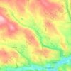
Allihies topographic map

Click on the map to display elevation.

About this map

Name: Allihies topographic map, elevation, terrain.

Location: Allihies, West Cork, County Cork, Munster, P75 F635, Ireland (51.62137 -10.06444 51.66137 -10.02444)

Average elevation: 302 ft

Minimum elevation: -3 ft

Maximum elevation: 1,217 ft

Other topographic maps

Click on a map to view its topography, its elevation and its terrain.
Douglas

Ireland > County Cork > Cork

Average elevation: 112 ft

Watergrasshill

Ireland > County Cork

According to A Topographical Dictionary of Ireland, published by Samuel Lewis in 1837, Watergrasshill then had a population of 533 people.

Average elevation: 538 ft

Maryborough

Ireland > County Cork > Cork

Average elevation: 167 ft

Castlemartyr

Ireland > County Cork

Average elevation: 46 ft

Mitchelstown

Ireland > County Cork

Average elevation: 344 ft

Ballycotton

Ireland > County Cork

Average elevation: 36 ft

Knockraha

Ireland > County Cork

Average elevation: 374 ft

Passage West

Ireland > County Cork

Average elevation: 161 ft

Mallow

Ireland > County Cork

Average elevation: 253 ft

Ballyhoura

Ireland > County Cork

Average elevation: 525 ft

Kilworth

Ireland > County Cork

Average elevation: 374 ft

Cork City North West

Ireland > County Cork > Cork

Average elevation: 223 ft

Matehy

Ireland > County Cork

Average elevation: 351 ft

Municipal District of Cobh

Ireland > County Cork

Average elevation: 322 ft

Ballintemple

Ireland > County Cork > Cork

Average elevation: 66 ft

Skibbereen

Ireland > County Cork

Average elevation: 95 ft

Kilpatrick

Ireland > County Cork

Average elevation: 292 ft

Brinny

Ireland > County Cork

Average elevation: 200 ft

Cloyne

Ireland > County Cork

Average elevation: 131 ft

Macroom

Ireland > County Cork

Average elevation: 361 ft

Myrtleville Beach

Ireland > County Cork

Average elevation: 105 ft

Rockfort

Ireland > County Cork

Average elevation: 174 ft

Ballygarvan

Ireland > County Cork

Average elevation: 230 ft

Rossmore

Ireland > County Cork

Average elevation: 305 ft

Rathbarry

Ireland > County Cork

Average elevation: 112 ft

Elizabeth Fort

Ireland > County Cork > Cork

Average elevation: 92 ft

Ballincurrig

Ireland > County Cork

Average elevation: 135 ft

Licknavar

Ireland > County Cork

Average elevation: 148 ft

Grange

Ireland > County Cork > Cork

Average elevation: 164 ft

Coole East

Ireland > County Cork

Average elevation: 371 ft
Meenane

Ireland > County Cork

Average elevation: 568 ft

Dromnea

Ireland > County Cork

Average elevation: 223 ft

Baneshane

Ireland > County Cork

Average elevation: 36 ft

Greencloyne

Ireland > County Cork

Average elevation: 75 ft

Carrignavar

Ireland > County Cork

Average elevation: 423 ft

Dough

Ireland > County Cork

Average elevation: 115 ft

Rostellan

Ireland > County Cork

Average elevation: 135 ft

Kilcully

Ireland > County Cork > Cork

Average elevation: 272 ft

Killeens

Ireland > County Cork

Average elevation: 236 ft

Kilcredan

Ireland > County Cork

Average elevation: 180 ft

Gear up for your next adventure:

🧭GPS Watch Accessories - Bands and chargers for GPS watches
🛠️Outdoor Gear Repair Kit - Essential tools to fix gear on the trail
🗻Climbing Gear Basics - Essential gear for beginner climbers
🎒Day Hiking Backpack - Lightweight backpack perfect for day trips and outdoor adventures
🧤Tactile Hiking Gloves - Keep hands warm while operating GPS and smartphone screens

As an Amazon Associate, this site earns from qualifying purchases at no extra cost to you.