Geolocate

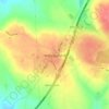
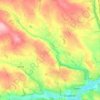
Milford topographic map

Click on the map to display elevation.

About this map

Name: Milford topographic map, elevation, terrain.

Location: Milford, The Municipal District of Kanturk-Mallow, County Cork, Munster, P56 PX32, Ireland (52.32088 -8.87608 52.36088 -8.83608)

Average elevation: 390 ft

Minimum elevation: 312 ft

Maximum elevation: 564 ft

Other topographic maps

Click on a map to view its topography, its elevation and its terrain.
Douglas

Ireland > County Cork > Cork

Average elevation: 112 ft

Watergrasshill

Ireland > County Cork

According to A Topographical Dictionary of Ireland, published by Samuel Lewis in 1837, Watergrasshill then had a population of 533 people.

Average elevation: 538 ft

Maryborough

Ireland > County Cork > Cork

Average elevation: 167 ft

Castlemartyr

Ireland > County Cork

Average elevation: 46 ft

Ballintemple

Ireland > County Cork > Cork

Average elevation: 66 ft

Mitchelstown

Ireland > County Cork

Average elevation: 344 ft

Ballycotton

Ireland > County Cork

Average elevation: 36 ft

Mallow

Ireland > County Cork

Average elevation: 253 ft

Knockraha

Ireland > County Cork

Average elevation: 374 ft

Passage West

Ireland > County Cork

Average elevation: 161 ft

Ballyhoura

Ireland > County Cork

Average elevation: 525 ft

Kilworth

Ireland > County Cork

Average elevation: 374 ft

Cork City North West

Ireland > County Cork > Cork

Average elevation: 223 ft

Matehy

Ireland > County Cork

Average elevation: 351 ft

Municipal District of Cobh

Ireland > County Cork

Average elevation: 322 ft

Skibbereen

Ireland > County Cork

Average elevation: 95 ft

Kilpatrick

Ireland > County Cork

Average elevation: 292 ft

Brinny

Ireland > County Cork

Average elevation: 200 ft

Cloyne

Ireland > County Cork

Average elevation: 131 ft

Elizabeth Fort

Ireland > County Cork > Cork

Average elevation: 92 ft

Macroom

Ireland > County Cork

Average elevation: 361 ft

Myrtleville Beach

Ireland > County Cork

Average elevation: 105 ft

Rockfort

Ireland > County Cork

Average elevation: 174 ft

Ballygarvan

Ireland > County Cork

Average elevation: 230 ft

Rossmore

Ireland > County Cork

Average elevation: 305 ft

Rathbarry

Ireland > County Cork

Average elevation: 112 ft

Ballincurrig

Ireland > County Cork

Average elevation: 135 ft

Licknavar

Ireland > County Cork

Average elevation: 148 ft

Grange

Ireland > County Cork > Cork

Average elevation: 164 ft

Coole East

Ireland > County Cork

Average elevation: 371 ft
Meenane

Ireland > County Cork

Average elevation: 568 ft

Dromnea

Ireland > County Cork

Average elevation: 223 ft

Baneshane

Ireland > County Cork

Average elevation: 36 ft

Greencloyne

Ireland > County Cork

Average elevation: 75 ft

Carrignavar

Ireland > County Cork

Average elevation: 423 ft

Dough

Ireland > County Cork

Average elevation: 115 ft

Rostellan

Ireland > County Cork

Average elevation: 135 ft

Kilcully

Ireland > County Cork > Cork

Average elevation: 272 ft

Killeens

Ireland > County Cork

Average elevation: 236 ft

Kilcredan

Ireland > County Cork

Average elevation: 180 ft

Gear up for your next adventure:

🪄Magnetic Compass - Accurate compass for navigation
🔭Stargazing Telescopes - Perfect for camping in low-light pollution areas shown on maps
🧭Pro Hiking Compasses - High-accuracy liquid-filled compasses for topographic orientation
🪶Survival Guide Book - Expert advice for emergency preparedness
🎁Geography Themed Gifts - Unique gift ideas for map lovers and geography enthusiasts

As an Amazon Associate, this site earns from qualifying purchases at no extra cost to you.