Geolocate

St. Louis topographic map

Click on the map to display elevation.

About this map

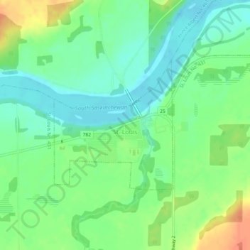
Name: St. Louis topographic map, elevation, terrain.

Location: St. Louis, Division No. 15, Saskatchewan, Canada (52.91482 -105.82189 52.92887 -105.80050)

Average elevation: 1,453 ft

Minimum elevation: 1,398 ft

Maximum elevation: 1,542 ft

Other topographic maps

Click on a map to view its topography, its elevation and its terrain.

Carmel

Canada > Saskatchewan > Division No. 15 > Humboldt No. 370

Average elevation: 1,880 ft

Humboldt

Canada > Saskatchewan > Division No. 15

Average elevation: 1,857 ft

Wingard

Canada > Saskatchewan > Division No. 15

Average elevation: 1,647 ft

Batoche

Canada > Saskatchewan > Division No. 15

Average elevation: 1,555 ft

Gear up for your next adventure:

🧷Carabiner Set - Durable clips for gear attachment
🧭Outdoor Navigation Book - Learn advanced navigation skills
🔦LED Headlamp - Bright and durable LED headlamp for night navigation
🧺Microfiber Travel Towels - Compact and fast-drying towels for trail use
🛌Ultralight Sleeping Bags - Compact down bags for cold nights in the wilderness

As an Amazon Associate, this site earns from qualifying purchases at no extra cost to you.