Geolocate

Batoche topographic map

Click on the map to display elevation.

About this map

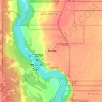
Name: Batoche topographic map, elevation, terrain.

Location: Batoche, Division No. 15, Saskatchewan, Canada (52.73601 -106.13794 52.77601 -106.09794)

Average elevation: 1,555 ft

Minimum elevation: 1,424 ft

Maximum elevation: 1,627 ft

Other topographic maps

Click on a map to view its topography, its elevation and its terrain.

Laird

Canada > Saskatchewan > Division No. 15

Average elevation: 1,732 ft

Garden River No. 490

Canada > Saskatchewan > Division No. 15

Average elevation: 1,532 ft

Aberdeen

Canada > Saskatchewan > Division No. 15

Average elevation: 1,699 ft

Humboldt

Canada > Saskatchewan > Division No. 15

Average elevation: 1,857 ft

Rosthern

Canada > Saskatchewan > Division No. 15

Average elevation: 1,670 ft

Humboldt

Canada > Saskatchewan > Division No. 15

Average elevation: 1,857 ft

St. Louis

Canada > Saskatchewan > Division No. 15

Average elevation: 1,453 ft

Duck Lake

Canada > Saskatchewan > Division No. 15

Average elevation: 1,657 ft

Candle Lake

Canada > Saskatchewan > Division No. 15

Average elevation: 1,667 ft

Gear up for your next adventure:

🪑Portable Camp Table - Compact table for campsite meals
🩳Quick‑Dry Hiking Shorts - Comfortable and quick‑dry shorts for summer hiking
🧴Hand Sanitizer - Keep hands clean while hiking
🪶Multi‑Purpose Knife - Useful blade for camp and trail
🧢Sun Protection Hats - Wide-brimmed and UPF-rated hats for high-altitude sun safety

As an Amazon Associate, this site earns from qualifying purchases at no extra cost to you.