
太和镇 topographic map
Interactive map
Click on the map to display elevation.
About this map
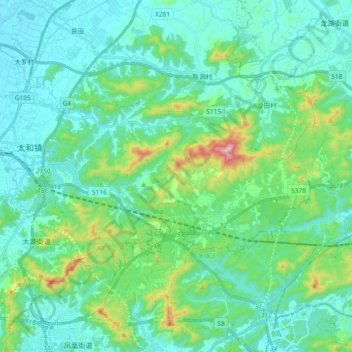
Name: 太和镇 topographic map, elevation, terrain.
Location: 太和镇, 白云区, 广州市, 广东省, 510540, 中国 (23.23398 113.32036 23.32943 113.50457)
Average elevation: 335 ft
Minimum elevation: 26 ft
Maximum elevation: 1,683 ft
Other topographic maps
Click on a map to view its topography, its elevation and its terrain.