
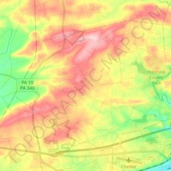
West Caln Township topographic map
Interactive map
Click on the map to display elevation.
About this map
Name: West Caln Township topographic map, elevation, terrain.
Average elevation: 673 ft
Minimum elevation: 328 ft
Maximum elevation: 1,001 ft
Other topographic maps
Click on a map to view its topography, its elevation and its terrain.
Whiteland Crest
United States > Pennsylvania > Chester County > West Whiteland Township > Exton
Whiteland Crest, Exton, West Whiteland Township, Chester County, Pennsylvania, 19381, United States
Average elevation: 417 ft
West Chester
United States > Pennsylvania > Chester County
West Chester, Chester County, Pennsylvania, 19383, United States
Average elevation: 413 ft
Malvern
United States > Pennsylvania > Chester County
Malvern, Chester County, Pennsylvania, 19355, United States
Average elevation: 502 ft
Phoenixville
United States > Pennsylvania > Chester County
Phoenixville, Chester County, Pennsylvania, United States
Average elevation: 180 ft
Downingtown
United States > Pennsylvania > Chester County
Downingtown, Chester County, Pennsylvania, 19335, United States
Average elevation: 348 ft
Pottstown Landing
United States > Pennsylvania > Chester County > North Coventry Township
Pottstown Landing, North Coventry Township, Chester County, Pennsylvania, 19465, United States
Average elevation: 217 ft
West Pikeland Township
United States > Pennsylvania > Chester County
West Pikeland Township, Chester County, Pennsylvania, 19425, United States
Average elevation: 417 ft
Kemblesville
United States > Pennsylvania > Chester County > Franklin Township
Kemblesville, Franklin Township, Chester County, Pennsylvania, 19347, United States
Average elevation: 341 ft
Nottingham
United States > Pennsylvania > Chester County > West Nottingham Township
Nottingham, West Nottingham Township, Chester County, Pennsylvania, 19362, United States
Average elevation: 476 ft
flood plane
United States > Pennsylvania > Chester County > Uwchlan Township > Lionville
flood plane, Lionville, Uwchlan Township, Chester County, Pennsylvania, United States
Average elevation: 489 ft
Brandamore
United States > Pennsylvania > Chester County > West Brandywine Township
Brandamore, West Brandywine Township, Chester County, Pennsylvania, 19316, United States
Average elevation: 627 ft
East Nottingham Township
United States > Pennsylvania > Chester County
East Nottingham Township, Chester County, Pennsylvania, United States
Average elevation: 449 ft
Lionville
United States > Pennsylvania > Chester County > Uwchlan Township
Lionville, Uwchlan Township, Chester County, Pennsylvania, 19381, United States
Average elevation: 489 ft
Cochranville
United States > Pennsylvania > Chester County > West Fallowfield Township
Cochranville, West Fallowfield Township, Chester County, Pennsylvania, 19330, United States
Average elevation: 558 ft
Warwick
United States > Pennsylvania > Chester County > Warwick Township
Warwick, Warwick Township, Chester County, Pennsylvania, 19520, United States
Average elevation: 607 ft
Chatwood
United States > Pennsylvania > Chester County > West Goshen Township
Chatwood, West Goshen Township, Chester County, Pennsylvania, 19392, United States
Average elevation: 423 ft
Darlington Corners
United States > Pennsylvania > Chester County > Thornbury Township > Westtown
Darlington Corners, Westtown, Thornbury Township, Chester County, Pennsylvania, 19382, United States
Average elevation: 364 ft
Cedarville
United States > Pennsylvania > Chester County > North Coventry Township
Cedarville, North Coventry Township, Chester County, Pennsylvania, 19465, United States
Average elevation: 269 ft
Pughtown
United States > Pennsylvania > Chester County > South Coventry Township
Pughtown, South Coventry Township, Chester County, Pennsylvania, 19421, United States
Average elevation: 400 ft
Embreeville
United States > Pennsylvania > Chester County > Newlin Township
Embreeville, Newlin Township, Chester County, Pennsylvania, 19308, United States
Average elevation: 351 ft
Thorndale
United States > Pennsylvania > Chester County > Caln Township
Thorndale, Caln Township, Chester County, Pennsylvania, 19372, United States
Average elevation: 423 ft
Hamorton
United States > Pennsylvania > Chester County > Kennett Township
Hamorton, Kennett Township, Chester County, Pennsylvania, 19340, United States
Average elevation: 387 ft
West Grove
United States > Pennsylvania > Chester County
West Grove, Chester County, Pennsylvania, United States
Average elevation: 420 ft
South Coatesville
United States > Pennsylvania > Chester County
South Coatesville, Chester County, Pennsylvania, 13920, United States
Average elevation: 430 ft
Suplee
United States > Pennsylvania > Chester County > Honey Brook Township
Suplee, Honey Brook Township, Chester County, Pennsylvania, 19344, United States
Average elevation: 666 ft
Saint Peters
United States > Pennsylvania > Chester County > Warwick Township
Saint Peters, Warwick Township, Chester County, Pennsylvania, United States
Average elevation: 515 ft
Hallman
United States > Pennsylvania > Chester County > East Pikeland Township
Hallman, East Pikeland Township, Chester County, Pennsylvania, 19442, United States
Average elevation: 308 ft
Faggs Manor
United States > Pennsylvania > Chester County > Londonderry Township
Faggs Manor, Londonderry Township, Chester County, Pennsylvania, 19330, United States
Average elevation: 581 ft
Unionville
United States > Pennsylvania > Chester County > East Marlborough Township
Unionville, East Marlborough Township, Chester County, Pennsylvania, 19375, United States
Average elevation: 440 ft
Springdell
United States > Pennsylvania > Chester County > West Marlborough Township
Springdell, West Marlborough Township, Chester County, Pennsylvania, United States
Average elevation: 433 ft
Lyndell
United States > Pennsylvania > Chester County > East Brandywine Township
Lyndell, East Brandywine Township, Chester County, Pennsylvania, 19354, United States
Average elevation: 449 ft
Icedale
United States > Pennsylvania > Chester County > West Brandywine Township
Icedale, West Brandywine Township, Chester County, Pennsylvania, 19316, United States
Average elevation: 650 ft
Hayti
United States > Pennsylvania > Chester County > Valley Township
Hayti, Valley Township, Chester County, Pennsylvania, 13920, United States
Average elevation: 495 ft
Steelville
United States > Pennsylvania > Chester County > West Fallowfield Township
Steelville, West Fallowfield Township, Chester County, Pennsylvania, 17509, United States
Average elevation: 538 ft
Mendenhall
United States > Pennsylvania > Chester County > Kennett Township
Mendenhall, Kennett Township, Chester County, Pennsylvania, 19357, United States
Average elevation: 361 ft
Ludwigs Corner
United States > Pennsylvania > Chester County > West Vincent Township
Ludwigs Corner, West Vincent Township, Chester County, Pennsylvania, 19480, United States
Average elevation: 597 ft
Lenape
United States > Pennsylvania > Chester County > Pocopson Township > Pocopson
Lenape, Pocopson, Pocopson Township, Chester County, Pennsylvania, 19366, United States
Average elevation: 259 ft
Isabella
United States > Pennsylvania > Chester County > West Nantmeal Township
Isabella, West Nantmeal Township, Chester County, Pennsylvania, 19520, United States
Average elevation: 656 ft
Hickory Hill
United States > Pennsylvania > Chester County > Elk Township
Hickory Hill, Elk Township, Chester County, Pennsylvania, 19352, United States
Average elevation: 404 ft
Goshenville
United States > Pennsylvania > Chester County > East Goshen Township
Goshenville, East Goshen Township, Chester County, Pennsylvania, 19360, United States
Average elevation: 433 ft
Compass
United States > Pennsylvania > Chester County > West Caln Township
Compass, West Caln Township, Chester County, Pennsylvania, United States
Average elevation: 610 ft
Eagleview
United States > Pennsylvania > Chester County > Uwchlan Township
Eagleview, Uwchlan Township, Chester County, Pennsylvania, 19480, United States
Average elevation: 495 ft
Nantmeal Village
United States > Pennsylvania > Chester County > East Nantmeal Township
Nantmeal Village, East Nantmeal Township, Chester County, Pennsylvania, United States
Average elevation: 561 ft
Mortonville
United States > Pennsylvania > Chester County > East Fallowfield Township
Mortonville, East Fallowfield Township, Chester County, Pennsylvania, 19358, United States
Average elevation: 400 ft
London Grove
United States > Pennsylvania > Chester County > West Marlborough Township
London Grove, West Marlborough Township, Chester County, Pennsylvania, 19374, United States
Average elevation: 430 ft
Knauertown
United States > Pennsylvania > Chester County > Warwick Township
Knauertown, Warwick Township, Chester County, Pennsylvania, United States
Average elevation: 495 ft
Ironsides
United States > Pennsylvania > Chester County > Schuylkill Township
Ironsides, Schuylkill Township, Chester County, Pennsylvania, 19460, United States
Average elevation: 200 ft
Harmonyville
United States > Pennsylvania > Chester County > Warwick Township
Harmonyville, Warwick Township, Chester County, Pennsylvania, United States
Average elevation: 574 ft
Toughkenamon
United States > Pennsylvania > Chester County > New Garden Township
Toughkenamon, New Garden Township, Chester County, Pennsylvania, 19374, United States
Average elevation: 377 ft
Whitford
United States > Pennsylvania > Chester County > West Whiteland Township
Whitford, West Whiteland Township, Chester County, Pennsylvania, 19341, United States
Average elevation: 400 ft