
帽峰山 topographic map
Interactive map
Click on the map to display elevation.
About this map
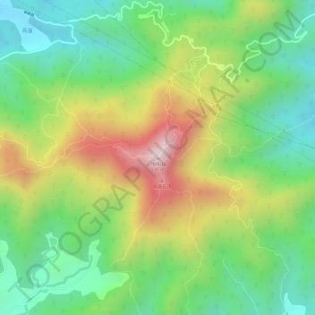
Name: 帽峰山 topographic map, elevation, terrain.
Location: 帽峰山, 广州市, 广东省, 中国 (23.29373 113.45952 23.29383 113.45962)
Average elevation: 840 ft
Minimum elevation: 233 ft
Maximum elevation: 1,683 ft
Other topographic maps
Click on a map to view its topography, its elevation and its terrain.