
从化区 topographic map
Interactive map
Click on the map to display elevation.
About this map
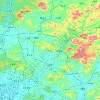
Name: 从化区 topographic map, elevation, terrain.
Location: 从化区, 广州市, 广东省, 中国 (23.37035 113.27618 23.93566 114.05476)
Average elevation: 600 ft
Minimum elevation: -3 ft
Maximum elevation: 3,822 ft
位于珠江三角洲的北部边缘,广州市东北部,广东省中部,境内多山,其中海拔1210米的天堂顶是广州最高峰,且有流溪河过境并建有水库。
Other topographic maps
Click on a map to view its topography, its elevation and its terrain.