Geolocate

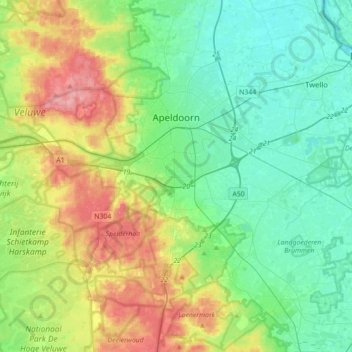
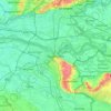
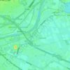
Apeldoorn topographic map

Click on the map to display elevation.

Apeldoorn

In 1689 William III became King of England, Scotland and Ireland and this elevation of his position and power brought an enlargement of Het Loo in its wake. Between 1691 and 1694 the colonnades which linked the corps de logis to the wings on either side were replaced by four pavilions. These pavilions contained the new apartments of William III and Mary II, a new Dining Room, a Long Gallery and a Chapel. Queen Mary did not return to the Netherlands after 1689 and never saw the enlargement.

Wikipedia (CC-BY-SA 3.0)

About this map

Name: Apeldoorn topographic map, elevation, terrain.

Location: Apeldoorn, Gelderland, Netherlands (52.07334 5.72639 52.28567 6.07848)

Average elevation: 118 ft

Minimum elevation: 3 ft

Maximum elevation: 361 ft

Other topographic maps

Click on a map to view its topography, its elevation and its terrain.

Enka Park

Netherlands > Gelderland > Ede

Average elevation: 59 ft

Wageningen-Hoog

Netherlands > Gelderland > Wageningen

Average elevation: 89 ft

Voorstonden

Netherlands > Gelderland > Brummen

Average elevation: 26 ft

Arnhem

Netherlands > Gelderland > Arnhem

Average elevation: 79 ft

Nijmegen

Netherlands > Gelderland > Nijmegen

Average elevation: 52 ft

Pijpenkast

Netherlands > Gelderland > Geldermalsen

Average elevation: 13 ft

Waterberg

Netherlands > Gelderland > Hoenderloo

Average elevation: 266 ft

Bakenberg

Netherlands > Gelderland > Ugchelen

Average elevation: 164 ft

Sonsbeek

Netherlands > Gelderland > Arnhem

Average elevation: 141 ft

Achterhoek

Netherlands > Gelderland > Nijkerk

Average elevation: 3 ft

Holkerveen

Netherlands > Gelderland

Average elevation: 10 ft

Elden

Netherlands > Gelderland > Arnhem

Average elevation: 36 ft

Oosteinde

Netherlands > Gelderland > Nunspeet

Average elevation: 26 ft

Nieuwgraaf

Netherlands > Gelderland > Duiven

Average elevation: 36 ft

Kops Plateau

Netherlands > Gelderland > Nijmegen

Average elevation: 118 ft

Bradaal

Netherlands > Gelderland > Culemborg > Bradaal

Average elevation: 3 ft

Gear up for your next adventure:

🌡️Handheld Weather Meters - Measure wind, temp, and pressure for safe mountain travel
🔌USB Car Charger - Car charger for on‑the‑go power needs
📶Satellite Messenger - Communication device off‑grid
🪶Multi‑Purpose Knife - Useful blade for camp and trail
🧭Pro Hiking Compasses - High-accuracy liquid-filled compasses for topographic orientation

As an Amazon Associate, this site earns from qualifying purchases at no extra cost to you.