
伊川县 topographic map
Interactive map
Click on the map to display elevation.
About this map
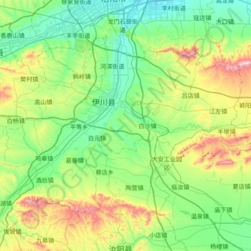
Name: 伊川县 topographic map, elevation, terrain.
Location: 伊川县, 洛阳市, 河南省, 中国 (34.21415 112.19956 34.54480 112.76886)
Average elevation: 1,099 ft
Minimum elevation: 433 ft
Maximum elevation: 3,189 ft
Other topographic maps
Click on a map to view its topography, its elevation and its terrain.