Geolocate

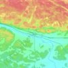
Target Island topographic map

Click on the map to display elevation.

About this map

Name: Target Island topographic map, elevation, terrain.

Location: Target Island, West Nipissing, Nipissing District, Northeastern Ontario, Ontario, Canada (46.22414 -79.82583 46.22512 -79.82222)

Average elevation: 636 ft

Minimum elevation: 623 ft

Maximum elevation: 709 ft

Other topographic maps

Click on a map to view its topography, its elevation and its terrain.
Lavigne

Canada > Ontario > Nipissing District > West Nipissing

Average elevation: 666 ft

Verner

Canada > Ontario > Nipissing District > West Nipissing

Average elevation: 748 ft

Glen Afton

Canada > Ontario > Nipissing District > West Nipissing

Average elevation: 899 ft

Gear up for your next adventure:

🧣Hiking Neck Gaiter - Multi‑use neck protection for outdoor weather
🧤Tactile Hiking Gloves - Keep hands warm while operating GPS and smartphone screens
🔪Outdoor Multitools - Essential survival tools for gear repair and field use
📦Gear Storage Bags - Organize and protect outdoor equipment
🔭Compact Binoculars - HD vision for scouting terrain and identifying distant landmarks

As an Amazon Associate, this site earns from qualifying purchases at no extra cost to you.