Geolocate

Verner topographic map

Click on the map to display elevation.

About this map
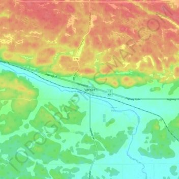
Name: Verner topographic map, elevation, terrain.

Location: Verner, West Nipissing, Nipissing District, Northeastern Ontario, Ontario, P0H 2M0, Canada (46.37124 -80.16335 46.45124 -80.08335)

Average elevation: 748 ft

Minimum elevation: 646 ft

Maximum elevation: 873 ft

Other topographic maps

Click on a map to view its topography, its elevation and its terrain.

Gear up for your next adventure:

🔌Solar Panel Charger - Charge gear sustainably outdoors
🥾Women's Hiking Boots - Top-rated trail boots with ankle support and superior grip
🪶Camp Gear Gift Set - Perfect gift bundle for outdoor fans
🧭Pro Hiking Compasses - High-accuracy liquid-filled compasses for topographic orientation
🍳Camping Cook Set - Complete cookware for outdoor meals

As an Amazon Associate, this site earns from qualifying purchases at no extra cost to you.