
Uduru topographic map
Click on the map to display elevation.
About this map
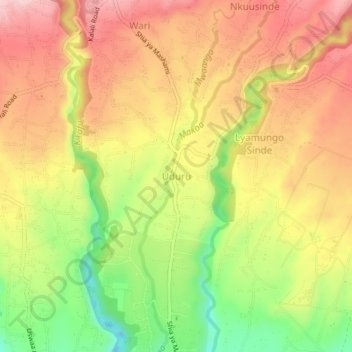
Name: Uduru topographic map, elevation, terrain.
Location: Uduru, Hai, Kilimanjaro, Northern Zone, Tanzania (-3.25620 37.20838 -3.21620 37.24838)
Average elevation: 4,203 ft
Minimum elevation: 3,724 ft
Maximum elevation: 4,583 ft
Other topographic maps
Click on a map to view its topography, its elevation and its terrain.
Kilimanjaro
Mount Kilimanjaro (/ˌkɪlɪmənˈdʒɑːroʊ/) is a dormant volcano in Tanzania. It is the highest mountain in Africa and the highest free-standing mountain above sea level in the world: 5,895 m (19,341 ft) above sea level and 4,900 m (16,100 ft) above its plateau base. It is also the highest volcano in the…
Average elevation: 5,043 ft
Kilimanjaro
The mountain was incorporated into Kilimanjaro National Park in 1973. As one of the Seven Summits, Kilimanjaro is a major hiking and climbing destination. There are seven established routes to Uhuru Peak, the mountain's highest point. Although not as technically challenging as similar mountains, the prominence…
Average elevation: 5,043 ft
Kilimanjaro
Kilimanjaro is the fourth most topographically prominent peak on Earth. It is part of Kilimanjaro National Park and is a major hiking and climbing destination. Because of its shrinking glaciers and ice fields, which are projected to disappear between 2025 and 2035, it has been the subject of many scientific…
Average elevation: 5,043 ft
Kilimanjaro
Mount Kilimanjaro (/ˌkɪlɪmənˈdʒɑːroʊ/) is a dormant volcano in Tanzania. It is the highest mountain in Africa and the highest free-standing mountain above sea level in the world: 5,895 m (19,341 ft) above sea level and 4,900 m (16,100 ft) above its plateau base. It is also the highest volcano in the…
Average elevation: 5,043 ft
Kilimanjaro
Mount Kilimanjaro (/ˌkɪlɪmənˈdʒɑːroʊ/) is a dormant volcano in Tanzania. It is the highest mountain in Africa and the highest free-standing mountain above sea level in the world, situated at 5,895 m (19,341 ft) above sea level and 4,900 m (16,100 ft) above its plateau base. It is also the highest…
Average elevation: 5,043 ft
Kilimanjaro
Mount Kilimanjaro (/ˌkɪlɪmənˈdʒɑːroʊ/) is a dormant volcano in Tanzania. It is the highest mountain in Africa and the highest free-standing mountain above sea level in the world, at 5,895 m (19,341 ft) above sea level and 4,900 m (16,100 ft) above its plateau base. It is also the highest volcano in…
Average elevation: 5,043 ft
Kilimanjaro
Mount Kilimanjaro (/ˌkɪlɪmənˈdʒɑːroʊ/) is a large dormant volcano in Tanzania. It is the highest mountain in Africa and the highest free-standing mountain above sea level in the world, at 5,895 m (19,341 ft) above sea level and 4,900 m (16,100 ft) above its plateau base. It is also the highest volcano…
Average elevation: 5,043 ft
Lake Chala
Lake Chala's average annual rainfall is about 565 millimetres (22.2 in). The lake surface has an average annual evaporation of near 1,735 millimetres (68.3 in). Approximately 80 percent of the lake's inflow comes from groundwater, which is derived mostly from rainfall in the montane forest zone of Mount…
Average elevation: 2,953 ft
Kilimanjaro
Kilimanjaro is the fourth most topographically prominent peak on Earth. It is part of Kilimanjaro National Park and is a major hiking and climbing destination. Because of its shrinking glaciers and ice fields, which are projected to disappear between 2025 and 2035, it has been the subject of many scientific…
Average elevation: 5,043 ft
Kilimanjaro
Mount Kilimanjaro (/ˌkɪlɪmənˈdʒɑːroʊ/) is a dormant volcano in Tanzania. It is the highest mountain in Africa and the highest free-standing mountains above sea level in the world, at 5,895 m (19,341 ft) above sea level and 4,900 m (16,100 ft) above its plateau base. It is also the highest volcano in…
Average elevation: 5,043 ft