Geolocate

Stringtown topographic map

Click on the map to display elevation.

👉 Easily get elevation data in JSON, GeoTIFF and KML formats using Elevation API
Thank you for supporting this site ❤️
Make a donation

About this map

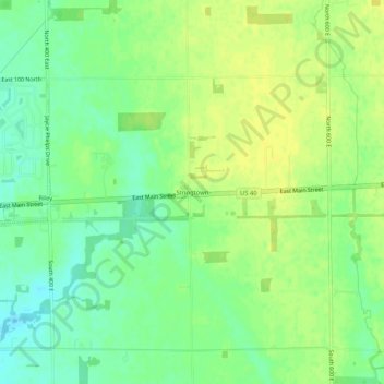
Name: Stringtown topographic map, elevation, terrain.

Location: Stringtown, Hancock County, Indiana, United States (39.76824 -85.72754 39.80824 -85.68754)

Average elevation: 915 ft

Minimum elevation: 879 ft

Maximum elevation: 942 ft

Hancock County trails, hiking, mountain biking, running and outdoor activities

Other topographic maps

Click on a map to view its topography, its elevation and its terrain.

Wilkinson

United States > Indiana > Hancock County

Average elevation: 1,007 ft

Spring Lake

United States > Indiana > Hancock County

Average elevation: 850 ft

New Palestine

United States > Indiana > Hancock County

Average elevation: 830 ft

Cumberland

United States > Indiana > Hancock County

Average elevation: 856 ft

Fortville

United States > Indiana > Hancock County

Average elevation: 863 ft

Gear up for your next adventure:

🧢Outdoor Hiking Hat - Sun protection hat for outdoor explorers
🛠️Backpacking Tool Kit - Essential toolkit for outdoor repairs
🛶Inflatable Kayak - Portable kayak for rivers, lakes, and expeditions
🎒Trail Energy Bars - High‑calorie bars for hiking energy
🪶Camp Gear Gift Set - Perfect gift bundle for outdoor fans

As an Amazon Associate, this site earns from qualifying purchases at no extra cost to you.