Geolocate

Spring Lake topographic map

Click on the map to display elevation.

👉 Easily get elevation data in JSON, GeoTIFF and KML formats using Elevation API
Thank you for supporting this site ❤️
Make a donation

About this map

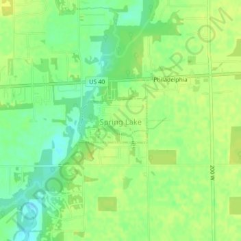
Name: Spring Lake topographic map, elevation, terrain.

Location: Spring Lake, Hancock County, Indiana, United States (39.77431 -85.85886 39.77932 -85.84894)

Average elevation: 850 ft

Minimum elevation: 814 ft

Maximum elevation: 873 ft

Hancock County trails, hiking, mountain biking, running and outdoor activities

Other topographic maps

Click on a map to view its topography, its elevation and its terrain.

Gem

United States > Indiana > Hancock County

Average elevation: 856 ft

Milners Corner

United States > Indiana > Hancock County

Average elevation: 928 ft

Mohawk

United States > Indiana > Hancock County

Average elevation: 869 ft

Mount Comfort

United States > Indiana > Hancock County

Average elevation: 860 ft

Nashville

United States > Indiana > Hancock County

Average elevation: 948 ft

Pleasant Acres

United States > Indiana > Hancock County

Average elevation: 860 ft

Riley

United States > Indiana > Hancock County > Greenfield

Average elevation: 902 ft

Stringtown

United States > Indiana > Hancock County

Average elevation: 915 ft

Westland

United States > Indiana > Hancock County

Average elevation: 912 ft

Woodbury

United States > Indiana > Hancock County

Average elevation: 860 ft

Eden

United States > Indiana > Hancock County

Average elevation: 889 ft

Maxwell

United States > Indiana > Hancock County

Average elevation: 906 ft

Philadelphia

United States > Indiana > Hancock County

Average elevation: 856 ft

Warrington

United States > Indiana > Hancock County

Average elevation: 974 ft

Willow Branch

United States > Indiana > Hancock County

Average elevation: 942 ft

Charlottesville

United States > Indiana > Hancock County

Average elevation: 965 ft

Carrollton

United States > Indiana > Hancock County

Average elevation: 840 ft

Gear up for your next adventure:

🖼️Topo Map Wall Art - Decorative topographic prints of famous peaks and regions
🎒Outdoor Daypacks - Lightweight backpacks designed for carrying maps and essential gear
🎒Waterproof Dry Bags - Keep your electronics and maps dry inside your pack
🔪Outdoor Multitools - Essential survival tools for gear repair and field use
🧴Hand Sanitizer - Keep hands clean while hiking

As an Amazon Associate, this site earns from qualifying purchases at no extra cost to you.