
Ridgely topographic map
Click on the map to display elevation.
Ridgely
A post office called Ridgely was established in 1848, and remained in operation until 1902. The community most likely was so named on account of its lofty elevation.
About this map
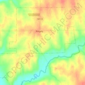
Name: Ridgely topographic map, elevation, terrain.
Location: Ridgely, Platte County, Missouri, United States (39.44078 -94.65694 39.46318 -94.62364)
Average elevation: 909 ft
Minimum elevation: 807 ft
Maximum elevation: 981 ft
Platte County trails, hiking, mountain biking, running and outdoor activities
Other topographic maps
Click on a map to view its topography, its elevation and its terrain.