Geolocate

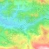
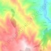
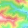
Gozón topographic map

Click on the map to display elevation.

About this map

Name: Gozón topographic map, elevation, terrain.

Location: Gozón, Asturias, Spain (43.55213 -5.94799 43.66653 -5.76521)

Average elevation: 115 ft

Minimum elevation: -33 ft

Maximum elevation: 551 ft

Other topographic maps

Click on a map to view its topography, its elevation and its terrain.
El Ferrol

Spain > Asturias > Castropol

Average elevation: 128 ft

Avín

Spain > Asturias > Onís > Benia de Onís

Average elevation: 1,289 ft

Boriñes

Spain > Asturias > Piloña

Average elevation: 1,017 ft

Chagos

Spain > Asturias > Cangas del Narcea > Ḷḷarón > La Vilieḷḷa

Average elevation: 3,143 ft

Liares

Spain > Asturias > Ibias

Average elevation: 2,339 ft

El Retornu

Spain > Asturias > Piloña

Average elevation: 1,942 ft

Sotrondio

Spain > Asturias > Samartín del Rei Aurelio

Average elevation: 1,391 ft

La Barganiza

Spain > Asturias > Siero

Average elevation: 653 ft

Siecha

Spain > Asturias > Cangas del Narcea

Average elevation: 2,927 ft

Gear up for your next adventure:

🦟Ultrasonic Repellers - Create a bug-free zone at your camp or rest stop
🥩Freeze-Dried Meals - Nutritious and lightweight food for remote expeditions
🖼️Topo Map Wall Art - Decorative topographic prints of famous peaks and regions
🧦Hiking Socks - Comfortable socks to prevent blisters on long hikes
📷Action Cameras - Rugged cameras to document your journeys across rugged terrain

As an Amazon Associate, this site earns from qualifying purchases at no extra cost to you.