
Make a donation
Gear up for your next adventure:
As an Amazon Associate, this site earns from qualifying purchases at no extra cost to you.
Helmand Province topographic map
Click on the map to display elevation.
Make a donation
Gear up for your next adventure:
As an Amazon Associate, this site earns from qualifying purchases at no extra cost to you.
About this map
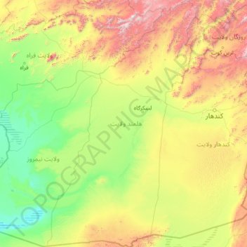
Name: Helmand Province topographic map, elevation, terrain.
Location: Helmand Province, Afghanistan (29.37729 62.55310 33.36983 65.37155)
Average elevation: 3,573 ft
Minimum elevation: 1,483 ft
Maximum elevation: 13,061 ft
Make a donation
Gear up for your next adventure:
As an Amazon Associate, this site earns from qualifying purchases at no extra cost to you.
Other topographic maps
Click on a map to view its topography, its elevation and its terrain.
Kabul
Afghanistan > Kabul Province > Kabul District
The modern-day city of Kabul is located high up in a narrow valley in the Hindu Kush, and is bounded by the Kabul River. At an elevation of 1,790 metres (5,873 ft), it is one of the highest capital cities in the world. The center of this city includes its old neighborhoods, which include the areas of Khashti…
Average elevation: 6,381 ft
Maymana
Afghanistan > Faryab Province > Maymana
Maymana is located at the northern foot of the Torkestan Range at an elevation of 877 m (2,877 ft) on the old terrace of the Qeysar or Maymana River, which is a right tributary of the Murghab River. The Maymana River branches off of the Band-e Turkistan River 50 km south of the city. The highlands of the…
Average elevation: 3,245 ft