Geolocate

Violet Lake topographic map

Click on the map to display elevation.

About this map

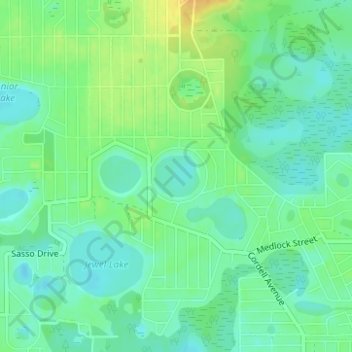
Name: Violet Lake topographic map, elevation, terrain.

Location: Violet Lake, Putnam County, Florida, United States (29.64964 -81.86461 29.65286 -81.86063)

Average elevation: 108 ft

Minimum elevation: 72 ft

Maximum elevation: 167 ft

Putnam County trails, hiking, mountain biking, running and outdoor activities

Other topographic maps

Click on a map to view its topography, its elevation and its terrain.

McMeekin

United States > Florida > Putnam County

Average elevation: 115 ft

Welaka

United States > Florida > Putnam County

Average elevation: 23 ft

Whiteville

United States > Florida > Putnam County

Average elevation: 125 ft

San Mateo

United States > Florida > Putnam County

San Mateo is located at 29°36′25″N 81°35′06″W / 29.607°N 81.585°W / 29.607; -81.585, with an elevation of 72 feet (22 m).

Average elevation: 33 ft

Satsuma

United States > Florida > Putnam County

Average elevation: 62 ft

Georges Lake

United States > Florida > Putnam County

Average elevation: 128 ft

Fruitland

United States > Florida > Putnam County > Fruitland

Average elevation: 26 ft

Bostwick

United States > Florida > Putnam County

Average elevation: 39 ft

Gear up for your next adventure:

👟Trail Running Shoes - Lightweight shoes for trail runners
🧴Hand Sanitizer - Keep hands clean while hiking
🔋Rechargeable Batteries - Power up your outdoor devices
🧦Hiking Socks - Comfortable socks to prevent blisters on long hikes
🌡️Portable Weather Meter - Track weather conditions on the trail

As an Amazon Associate, this site earns from qualifying purchases at no extra cost to you.