Geolocate

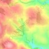
Brinny topographic map

Click on the map to display elevation.

About this map

Name: Brinny topographic map, elevation, terrain.

Location: Brinny, Brinny ED, The Municipal District of Bandon – Kinsale, County Cork, Munster, Ireland (51.77990 -8.71288 51.80182 -8.68831)

Average elevation: 200 ft

Minimum elevation: 52 ft

Maximum elevation: 587 ft

Other topographic maps

Click on a map to view its topography, its elevation and its terrain.

Skibbereen

Ireland > County Cork > Skibbereen

Average elevation: 157 ft

Cork

Ireland > County Cork > Cork

Average elevation: 308 ft

Mallow

Ireland > County Cork > Mallow

Average elevation: 348 ft

Ringaskiddy

Ireland > County Cork

Average elevation: 43 ft

Youghal

Ireland > County Cork > Youghal

Average elevation: 75 ft

Garnish Island

Ireland > County Cork

Average elevation: 433 ft

Glounthaune

Ireland > County Cork

Average elevation: 171 ft

Glanmire

Ireland > County Cork

Average elevation: 190 ft

Ballincollig

Ireland > County Cork > Cork

Average elevation: 203 ft

Waterfall

Ireland > County Cork

Average elevation: 315 ft

Mizen Head

Ireland > County Cork

Average elevation: 82 ft

Innishannon

Ireland > County Cork > Innishannon

Average elevation: 184 ft

Dripsey

Ireland > County Cork

Average elevation: 279 ft

Butter Bridge

Ireland > County Cork

Average elevation: 230 ft

Lombardstown

Ireland > County Cork

Average elevation: 295 ft

Allihies

Ireland > County Cork

Average elevation: 302 ft

Little Island

Ireland > County Cork

Average elevation: 112 ft

Ballydesmond

Ireland > County Cork > Ballydesmond

Average elevation: 807 ft

Myrtleville Beach

Ireland > County Cork

Average elevation: 105 ft

Passage West

Ireland > County Cork > Passage West

Average elevation: 108 ft

Milford

Ireland > County Cork

Average elevation: 390 ft

Elizabeth Fort

Ireland > County Cork > Cork

Average elevation: 92 ft

Leamlara

Ireland > County Cork

Average elevation: 476 ft

Abbey Mount

Ireland > County Cork

Average elevation: 302 ft

Castletownbere

Ireland > County Cork > Castletownbere

Average elevation: 289 ft

Gear up for your next adventure:

⌚GPS Sports Watch - GPS watch for running, hiking and training
🪶Trail Camera - Capture wildlife on your hikes
📦Dry Bags Set - Waterproof storage for electronics and clothes
📱Solar Portable Charger - Solar power bank for charging devices off‑grid
🌐World Map Poster - Decorative world maps with topographic info

As an Amazon Associate, this site earns from qualifying purchases at no extra cost to you.