
French Camp topographic map
Interactive map
Click on the map to display elevation.
About this map
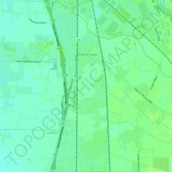
Name: French Camp topographic map, elevation, terrain.
Location: French Camp, San Joaquin County, California, United States (37.85562 -121.30344 37.89722 -121.26437)
Average elevation: 23 ft
Minimum elevation: 3 ft
Maximum elevation: 36 ft
San Joaquin County trails, hiking, mountain biking, running and outdoor activities
Other topographic maps
Click on a map to view its topography, its elevation and its terrain.
Lodi
United States > California > San Joaquin County
Lodi is flat terrain at an elevation of approximately 50 feet (15 m) above mean sea level datum. Historically, land in the area has been used for grazing as well as for grain production.
Average elevation: 10 ft
Mossdale Landing Community Park
United States > California > San Joaquin County > Lathrop
Average elevation: 13 ft
Lodi
United States > California > San Joaquin County
Lodi is flat terrain at an elevation of approximately 50 feet (15 m) above mean sea level datum. Historically, land in the area has been used for grazing as well as for grain production.
Average elevation: 52 ft
Mountain House
United States > California > San Joaquin County
Mountain House lies on the foothills of the Diablo Range, and close to the Altamont Pass which is over 1,000 feet in elevation. It is on the border of Alameda and Contra Costa counties. According to the United States Census Bureau, the CDP covers an area of 3.2 square miles (8.3 km2), all of it land. The…
Average elevation: 72 ft
Lathrop
United States > California > San Joaquin County > Lathrop > Lathrop
Lathrop is located at 37°49′1″N 121°17′19″W / 37.81694°N 121.28861°W / 37.81694; -121.28861 (37.816904, -121.288633). The San Joaquin River is on the west side of Lathrop and has elevation of 20 feet (7 m).
Average elevation: 23 ft
Peters
United States > California > San Joaquin County > Peters
Peters is a census-designated place in San Joaquin County, California. Peters sits at an elevation of 112 feet (34 m). The 2010 United States census reported Peters' population was 672.
Average elevation: 105 ft
The Homestead
United States > California > San Joaquin County > Stockton > The Homestead
Average elevation: 20 ft