Geolocate

New Scotland topographic map

Click on the map to display elevation.

About this map

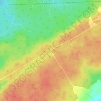
Name: New Scotland topographic map, elevation, terrain.

Location: New Scotland, Moncton Parish, Westmorland County, New Brunswick, Canada (46.24693 -64.91252 46.26693 -64.89252)

Average elevation: 279 ft

Minimum elevation: 184 ft

Maximum elevation: 341 ft

Other topographic maps

Click on a map to view its topography, its elevation and its terrain.

Sackville

Canada > New Brunswick > Westmorland County > Sackville

Average elevation: 102 ft

City of Dieppe

Canada > New Brunswick > Westmorland County

Average elevation: 141 ft

Memramcook

Canada > New Brunswick > Westmorland County

Average elevation: 194 ft

Memramcook

Canada > New Brunswick > Westmorland County

Average elevation: 187 ft

Town of Shediac

Canada > New Brunswick > Westmorland County

Its topography is relatively flat and its soil is mostly composed of sedimentary rocks dating from the Pennsylvanian. Shediac enjoys a continental climate.

Average elevation: 92 ft

Shediac

Canada > New Brunswick > Westmorland County

Average elevation: 56 ft

Gear up for your next adventure:

🧺Microfiber Travel Towels - Compact and fast-drying towels for trail use
🩹Survival Bandages - High‑quality bandages for emergencies
🔥Plasma Lighters - Windproof lighters that work in any weather condition
🔋Rechargeable Batteries - Power up your outdoor devices
🔭Stargazing Telescopes - Perfect for camping in low-light pollution areas shown on maps

As an Amazon Associate, this site earns from qualifying purchases at no extra cost to you.