Geolocate

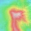
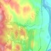
Westminster topographic map

Click on the map to display elevation.

About this map
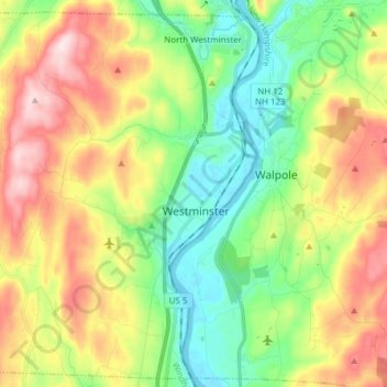
Name: Westminster topographic map, elevation, terrain.

Location: Westminster, Windham County, Vermont, United States (43.02036 -72.58564 43.12777 -72.43249)

Average elevation: 705 ft

Minimum elevation: 207 ft

Maximum elevation: 1,467 ft

Other topographic maps

Click on a map to view its topography, its elevation and its terrain.
Stratton Mountain

United States > Vermont > Windham County > Stratton

Average elevation: 3,268 ft

Mount Snow

United States > Vermont > Windham County

Average elevation: 2,835 ft

West Dover

United States > Vermont > Windham County > Dover

Average elevation: 1,913 ft

West Wardsboro

United States > Vermont > Windham County > Wardsboro

Average elevation: 1,696 ft

Guilford Center

United States > Vermont > Windham County > Guilford

Average elevation: 866 ft

Sherwood Forest

United States > Vermont > Windham County > Londonderry

Average elevation: 1,371 ft

North Windham

United States > Vermont > Windham County > Londonderry

Average elevation: 1,699 ft

Williamsville

United States > Vermont > Windham County > Newfane

Average elevation: 886 ft

East Dover

United States > Vermont > Windham County > Dover

Average elevation: 1,394 ft

Williamsville

United States > Vermont > Windham County > Newfane

Average elevation: 886 ft

Kenny Pond Dam

United States > Vermont > Windham County > Newfane

Average elevation: 1,355 ft

West Townshend

United States > Vermont > Windham County > Townshend

Average elevation: 968 ft

South Newfane

United States > Vermont > Windham County > Newfane

Average elevation: 1,053 ft

West Guilford

United States > Vermont > Windham County > Guilford

Average elevation: 1,129 ft

Mount Snow

United States > Vermont > Windham County

Average elevation: 2,838 ft

East Dover

United States > Vermont > Windham County > Dover

Average elevation: 1,394 ft

Sherwood Forest

United States > Vermont > Windham County > Londonderry

Average elevation: 1,371 ft

Packer Corner

United States > Vermont > Windham County > Guilford

Average elevation: 1,001 ft

Gear up for your next adventure:

🪄Magnetic Compass - Accurate compass for navigation
🛠️Outdoor Gear Repair Kit - Essential tools to fix gear on the trail
🥩Freeze-Dried Meals - Nutritious and lightweight food for remote expeditions
🎒Trail Energy Bars - High‑calorie bars for hiking energy
📱Heavy-Duty Phone Cases - Drop-proof and waterproof protection for outdoor navigation

As an Amazon Associate, this site earns from qualifying purchases at no extra cost to you.