
Kamet topographic map
Click on the map to display elevation.
About this map
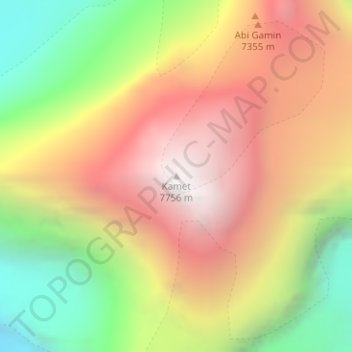
Name: Kamet topographic map, elevation, terrain.
Location: Kamet, Joshimath Tehsil, Chamoli, Uttarakhand, India (30.92009 79.59261 30.92019 79.59271)
Average elevation: 21,985 ft
Minimum elevation: 18,445 ft
Maximum elevation: 25,180 ft
Other topographic maps
Click on a map to view its topography, its elevation and its terrain.
Valley of Flowers National Park
India > Uttarakhand > Joshimath Tehsil > Ghangaria
Average elevation: 15,112 ft
Valley of Flowers National Park
India > Uttarakhand > Joshimath Tehsil > Ghangaria
Average elevation: 15,112 ft