
乐洞乡 topographic map
Interactive map
Click on the map to display elevation.
About this map
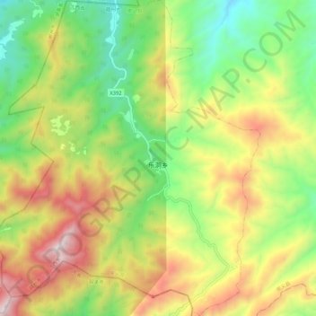
Name: 乐洞乡 topographic map, elevation, terrain.
Location: 乐洞乡, 崇义县, 赣州市, 江西省, 中国 (25.43961 113.93466 25.53468 114.02259)
Average elevation: 2,989 ft
Minimum elevation: 1,394 ft
Maximum elevation: 5,141 ft
Other topographic maps
Click on a map to view its topography, its elevation and its terrain.