Geolocate

Jenkins topographic map

Click on the map to display elevation.

About this map

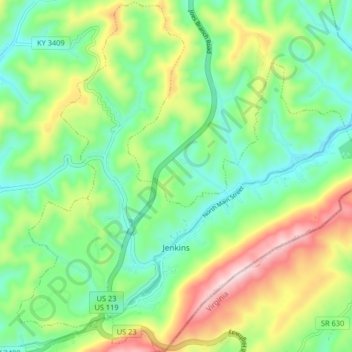
Name: Jenkins topographic map, elevation, terrain.

Location: Jenkins, Letcher County, Kentucky, 41517, United States (37.15396 -82.66786 37.21866 -82.58633)

Average elevation: 1,936 ft

Minimum elevation: 1,421 ft

Maximum elevation: 2,927 ft

Letcher County trails, hiking, mountain biking, running and outdoor activities

Other topographic maps

Click on a map to view its topography, its elevation and its terrain.

Defeated Creek

United States > Kentucky > Letcher County

Average elevation: 1,614 ft

Gordon

United States > Kentucky > Letcher County

Average elevation: 1,926 ft

Ermine

United States > Kentucky > Letcher County > Ermine

Average elevation: 1,467 ft

Neon

United States > Kentucky > Letcher County > Fleming-Neon

Average elevation: 1,594 ft

Dunham

United States > Kentucky > Letcher County > Jenkins

Average elevation: 1,847 ft

Gear up for your next adventure:

🔪Outdoor Multitools - Essential survival tools for gear repair and field use
📚USA Hiking Guide Books - Top trail guides and map books
🗻Climbing Gear Basics - Essential gear for beginner climbers
🧭Pro Hiking Compasses - High-accuracy liquid-filled compasses for topographic orientation
🧢Sun Protection Hats - Wide-brimmed and UPF-rated hats for high-altitude sun safety

As an Amazon Associate, this site earns from qualifying purchases at no extra cost to you.