Geolocate

Roseland topographic map

Click on the map to display elevation.

About this map

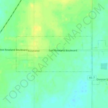
Name: Roseland topographic map, elevation, terrain.

Location: Roseland, Cherokee County, Kansas, United States (37.27590 -94.85605 37.28478 -94.83214)

Average elevation: 912 ft

Minimum elevation: 883 ft

Maximum elevation: 948 ft

Cherokee County trails, hiking, mountain biking, running and outdoor activities

Other topographic maps

Click on a map to view its topography, its elevation and its terrain.

Riverton

United States > Kansas > Cherokee County

Average elevation: 833 ft

Treece

United States > Kansas > Cherokee County

Average elevation: 843 ft

Lowell

United States > Kansas > Cherokee County

Average elevation: 814 ft

Gear up for your next adventure:

🔌USB Car Charger - Car charger for on‑the‑go power needs
🔥Camping Stove - Portable stove for camping and backcountry cooking
🛰️Satellite Messengers - Emergency SOS and two-way messaging for off-grid adventures
🔦Compact Flashlight - Reliable flashlight for emergencies
📷Action Cameras - Rugged cameras to document your journeys across rugged terrain

As an Amazon Associate, this site earns from qualifying purchases at no extra cost to you.