Geolocate

Lowell topographic map

Click on the map to display elevation.

About this map

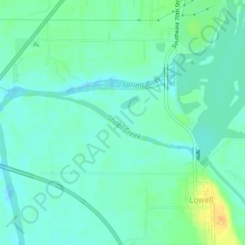
Name: Lowell topographic map, elevation, terrain.

Location: Lowell, Cherokee County, Kansas, United States, Shoal Creek (37.05528 -94.72236 37.06169 -94.70093)

Average elevation: 814 ft

Minimum elevation: 784 ft

Maximum elevation: 892 ft

Cherokee County trails, hiking, mountain biking, running and outdoor activities

Other topographic maps

Click on a map to view its topography, its elevation and its terrain.

Galena

United States > Kansas > Cherokee County

Average elevation: 925 ft

Scammon

United States > Kansas > Cherokee County

Average elevation: 915 ft

West Mineral

United States > Kansas > Cherokee County

Average elevation: 896 ft

Riverton

United States > Kansas > Cherokee County

Average elevation: 833 ft

Treece

United States > Kansas > Cherokee County

Average elevation: 843 ft

Roseland

United States > Kansas > Cherokee County

Average elevation: 912 ft

Gear up for your next adventure:

🧥Waterproof Jacket for Hiking - Breathable and rugged rain jacket for outdoor excursions
🧭Map Reading Tools - Tools and kits for map navigation
Backpacking Tent - Lightweight and durable tent for multi‑day hikes
🪶Survival Guide Book - Expert advice for emergency preparedness
🧭GPS Watch Accessories - Bands and chargers for GPS watches

As an Amazon Associate, this site earns from qualifying purchases at no extra cost to you.