Geolocate

Riverton topographic map

Click on the map to display elevation.

About this map

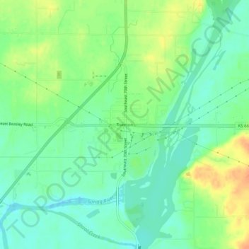
Name: Riverton topographic map, elevation, terrain.

Location: Riverton, Cherokee County, Kansas, 66770, United States (37.05506 -94.72467 37.09506 -94.68467)

Average elevation: 833 ft

Minimum elevation: 784 ft

Maximum elevation: 906 ft

Cherokee County trails, hiking, mountain biking, running and outdoor activities

Other topographic maps

Click on a map to view its topography, its elevation and its terrain.

Lowell

United States > Kansas > Cherokee County

Average elevation: 814 ft

Scammon

United States > Kansas > Cherokee County

Average elevation: 915 ft

West Mineral

United States > Kansas > Cherokee County

Average elevation: 896 ft

Roseland

United States > Kansas > Cherokee County

Average elevation: 912 ft

Galena

United States > Kansas > Cherokee County

Average elevation: 925 ft

Gear up for your next adventure:

📦Gear Storage Bags - Organize and protect outdoor equipment
🎒Gear Packing Cubes - Organize your backpack efficiently
🧷Carabiner Set - Durable clips for gear attachment
🗻Climbing Gear Basics - Essential gear for beginner climbers
🥾Men's Hiking Boots - Durable, waterproof footwear for rugged terrain and steep inclines

As an Amazon Associate, this site earns from qualifying purchases at no extra cost to you.