
Make a donation
Gear up for your next adventure:
As an Amazon Associate, this site earns from qualifying purchases at no extra cost to you.
Igloo Mountain topographic map
Click on the map to display elevation.
Make a donation
Gear up for your next adventure:
As an Amazon Associate, this site earns from qualifying purchases at no extra cost to you.
About this map
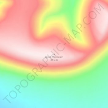
Name: Igloo Mountain topographic map, elevation, terrain.
Location: Igloo Mountain, North Slope, Alaska, United States (68.76710 -162.88341 68.76720 -162.88331)
Average elevation: 1,942 ft
Minimum elevation: 1,129 ft
Maximum elevation: 2,680 ft
North Slope trails, hiking, mountain biking, running and outdoor activities
Make a donation
Gear up for your next adventure:
As an Amazon Associate, this site earns from qualifying purchases at no extra cost to you.
Other topographic maps
Click on a map to view its topography, its elevation and its terrain.
Atqasuk
United States > Alaska > North Slope
Atqasuk has one airport, Atqasuk Edward Burnell Sr. Memorial Airport, that is uncontrolled and has a single 4,370-by-90-foot (1,332 by 27 m) runway at an elevation of 96 feet (29 m).
Average elevation: 66 ft
Make a donation
Gear up for your next adventure:
As an Amazon Associate, this site earns from qualifying purchases at no extra cost to you.