
Haliimaile topographic map
Click on the map to display elevation.
About this map
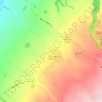
Name: Haliimaile topographic map, elevation, terrain.
Location: Haliimaile, Maui County, Hawaii, United States (20.85947 -156.36633 20.88638 -156.32554)
Average elevation: 1,020 ft
Minimum elevation: 456 ft
Maximum elevation: 1,522 ft
Maui County trails, hiking, mountain biking, running and outdoor activities
Other topographic maps
Click on a map to view its topography, its elevation and its terrain.