Geolocate

Cicero topographic map

Click on the map to display elevation.

About this map

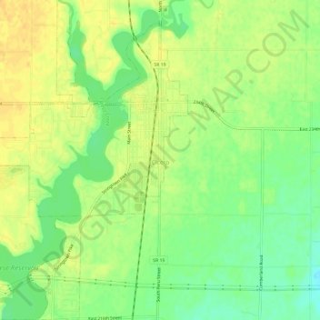
Name: Cicero topographic map, elevation, terrain.

Location: Cicero, Hamilton County, Indiana, 46034, United States (40.10165 -86.04705 40.14671 -86.00822)

Average elevation: 827 ft

Minimum elevation: 774 ft

Maximum elevation: 866 ft

Hamilton County trails, hiking, mountain biking, running and outdoor activities

Other topographic maps

Click on a map to view its topography, its elevation and its terrain.

Lake Windemere

United States > Indiana > Hamilton County > Carmel

Average elevation: 896 ft

Boxley

United States > Indiana > Hamilton County

Average elevation: 928 ft

Noblesville

United States > Indiana > Hamilton County

Average elevation: 791 ft

Carmel

United States > Indiana > Hamilton County > Carmel > Carmel

Average elevation: 833 ft

creek

United States > Indiana > Hamilton County > Westfield

Average elevation: 915 ft

Gear up for your next adventure:

🧢Sun Protection Hats - Wide-brimmed and UPF-rated hats for high-altitude sun safety
🔦LED Headlamp - Bright and durable LED headlamp for night navigation
📱Solar Portable Charger - Solar power bank for charging devices off‑grid
🛏️Cold Weather Sleeping Bag - Warm sleeping bag for cold conditions
🦺Reflective Outdoor Gear - Safety gear for low‑light conditions

As an Amazon Associate, this site earns from qualifying purchases at no extra cost to you.