Geolocate

Boxley topographic map

Click on the map to display elevation.

About this map

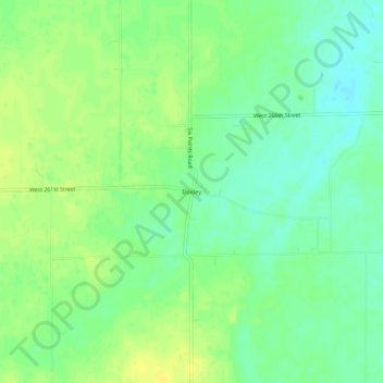
Name: Boxley topographic map, elevation, terrain.

Location: Boxley, Hamilton County, Indiana, United States (40.14615 -86.19555 40.18615 -86.15555)

Average elevation: 928 ft

Minimum elevation: 892 ft

Maximum elevation: 958 ft

Hamilton County trails, hiking, mountain biking, running and outdoor activities

Other topographic maps

Click on a map to view its topography, its elevation and its terrain.

Lake Windemere

United States > Indiana > Hamilton County > Carmel

Average elevation: 896 ft

Cicero

United States > Indiana > Hamilton County

Average elevation: 827 ft

Atlanta

United States > Indiana > Hamilton County

Average elevation: 863 ft

Arcadia

United States > Indiana > Hamilton County

Average elevation: 860 ft

creek

United States > Indiana > Hamilton County > Westfield

Average elevation: 915 ft

Sheridan

United States > Indiana > Hamilton County

Average elevation: 951 ft

Lake Ullswater

United States > Indiana > Hamilton County > Carmel

Average elevation: 899 ft

Gear up for your next adventure:

📡GPS Antenna Upgrade - Enhance GPS reception in remote terrain
🧣Hiking Neck Gaiter - Multi‑use neck protection for outdoor weather
🌲Outdoor Survival Books - Best books on survival skills
🧭Map Reading Tools - Tools and kits for map navigation
👓Polarized Sunglasses - Outdoor sunglasses for glare reduction

As an Amazon Associate, this site earns from qualifying purchases at no extra cost to you.