Geolocate

Warrington topographic map

Click on the map to display elevation.

About this map

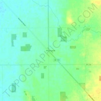
Name: Warrington topographic map, elevation, terrain.

Location: Warrington, Hancock County, Indiana, 46186, United States (39.88754 -85.65316 39.92754 -85.61316)

Average elevation: 974 ft

Minimum elevation: 942 ft

Maximum elevation: 1,024 ft

Hancock County trails, hiking, mountain biking, running and outdoor activities

Other topographic maps

Click on a map to view its topography, its elevation and its terrain.

Wilkinson

United States > Indiana > Hancock County

Average elevation: 1,007 ft

Spring Lake

United States > Indiana > Hancock County

Average elevation: 850 ft

New Palestine

United States > Indiana > Hancock County

Average elevation: 830 ft

Cumberland

United States > Indiana > Hancock County

Average elevation: 856 ft

Fortville

United States > Indiana > Hancock County

Average elevation: 863 ft

Gear up for your next adventure:

🔭Stargazing Telescopes - Perfect for camping in low-light pollution areas shown on maps
🪶Trail Camera - Capture wildlife on your hikes
Backpacking Tent - Lightweight and durable tent for multi‑day hikes
🥄Camping Utensil Set - Lightweight utensils for outdoor meals
🎒Hydration Pack - Hands‑free water reservoir for long hikes

As an Amazon Associate, this site earns from qualifying purchases at no extra cost to you.