Geolocate

Rosthern topographic map

Click on the map to display elevation.

About this map

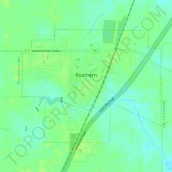
Name: Rosthern topographic map, elevation, terrain.

Location: Rosthern, Division No. 15, Saskatchewan, Canada (52.65320 -106.35199 52.67104 -106.31592)

Average elevation: 1,670 ft

Minimum elevation: 1,647 ft

Maximum elevation: 1,690 ft

Other topographic maps

Click on a map to view its topography, its elevation and its terrain.

Humboldt

Canada > Saskatchewan > Division No. 15

Average elevation: 1,857 ft

Carmel

Canada > Saskatchewan > Division No. 15 > Humboldt No. 370

Average elevation: 1,880 ft

Wingard

Canada > Saskatchewan > Division No. 15

Average elevation: 1,647 ft

Batoche

Canada > Saskatchewan > Division No. 15

Average elevation: 1,555 ft

Gear up for your next adventure:

🥾Women's Hiking Boots - Top-rated trail boots with ankle support and superior grip
🕶️Glacier Sunglasses - Side shields to protect eyes from high-altitude snow glare
🔭Telescopic Hiking Pole - Adjustable pole for hiking stability
🥇GPS Hiking Watch - Multi‑sport GPS watch with navigation and trail tracking
🏕️Family Camping Gear - Essentials for group camping trips

As an Amazon Associate, this site earns from qualifying purchases at no extra cost to you.