
Make a donation
Gear up for your next adventure:
As an Amazon Associate, this site earns from qualifying purchases at no extra cost to you.
Utica topographic map
Click on the map to display elevation.
Make a donation
Gear up for your next adventure:
As an Amazon Associate, this site earns from qualifying purchases at no extra cost to you.
About this map
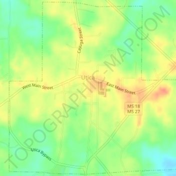
Name: Utica topographic map, elevation, terrain.
Location: Utica, Hinds County, Mississippi, United States (32.09369 -90.63874 32.12194 -90.60467)
Average elevation: 266 ft
Minimum elevation: 190 ft
Maximum elevation: 331 ft
Hinds County trails, hiking, mountain biking, running and outdoor activities
Make a donation
Gear up for your next adventure:
As an Amazon Associate, this site earns from qualifying purchases at no extra cost to you.
Other topographic maps
Click on a map to view its topography, its elevation and its terrain.
Make a donation
Gear up for your next adventure:
As an Amazon Associate, this site earns from qualifying purchases at no extra cost to you.
Lake Catherine
United States > Mississippi > Hinds County > Jackson > Lost Lake
Average elevation: 328 ft