
Town of Westport topographic map
Interactive map
Click on the map to display elevation.
About this map
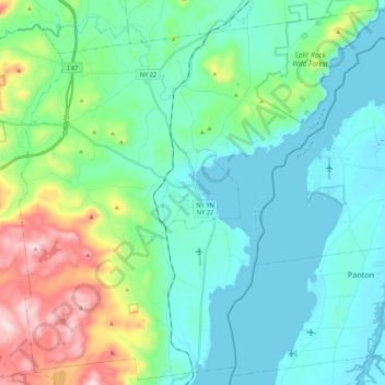
Name: Town of Westport topographic map, elevation, terrain.
Average elevation: 495 ft
Minimum elevation: 85 ft
Maximum elevation: 1,965 ft
Essex County trails, hiking, mountain biking, running and outdoor activities
Other topographic maps
Click on a map to view its topography, its elevation and its terrain.
Big Slide Mountain
United States > New York > Essex County > Town of Keene
Average elevation: 3,425 ft
Crown Point Center
United States > New York > Essex County > Town of Crown Point
Average elevation: 518 ft
Cold Spring Park
United States > New York > Essex County > Town of Crown Point
Average elevation: 840 ft
Burdick Crossing
United States > New York > Essex County > Town of Crown Point
Average elevation: 135 ft
Whiteface Mountain
United States > New York > Essex County
Whiteface Mountain is the fifth-highest mountain in the U.S. state of New York, and one of the High Peaks of the Adirondack Mountains. Set apart from most of the other High Peaks, the summit offers a 360-degree view of the Adirondacks and clear-day glimpses of Vermont and even Canada, where the skyscrapers of…
Average elevation: 3,576 ft
Blue Ridge Mountain
United States > New York > Essex County > Town of North Hudson
Average elevation: 2,684 ft
Fort Ticonderoga
United States > New York > Essex County > Town of Ticonderoga
Average elevation: 190 ft
Mount Marcy
United States > New York > Essex County > Town of Keene
Mount Marcy (Mohawk: Tewawe’éstha) is the highest point in New York, with an elevation of 5,343.1 feet (1,628.6 m). It is located in the Town of Keene in Essex County. The mountain is in the heart of the Adirondack High Peaks region of the High Peaks Wilderness Area. Its stature and expansive views make it…
Average elevation: 4,229 ft
Mount Pisgah
United States > New York > Essex County > Village of Saranac Lake
Average elevation: 1,647 ft