
Rattu topographic map
Click on the map to display elevation.
About this map
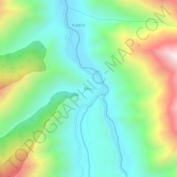
Name: Rattu topographic map, elevation, terrain.
Location: Rattu, Astore District, Gilgit-Baltistan, Pakistan (35.13168 74.77348 35.17168 74.81348)
Average elevation: 9,675 ft
Minimum elevation: 8,412 ft
Maximum elevation: 12,405 ft
Other topographic maps
Click on a map to view its topography, its elevation and its terrain.